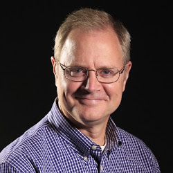
Kevin Selle
Wichita Falls, TX
Male, 55


I've been a broadcast meteorologist on television since the early 1990's. Happy to answer any questions about the weather or local TV news. Yes, I often wear sneakers on set just out of view of the camera.
We use the weather forecast models and the other tools mentioned in your other question to generate a forecast and then use television, radio and social media to share information.
Share Answer: 

No problem. Thanks for the information. It could be that a local weather source is using that term. “Officially” the term used by the National Weather Service is a tornado warning, and in some extreme situations a tornado emergency. Thanks again!
Share Answer: 
Yup! Any body of water. Glad you got to see one! https://en.m.wikipedia.org/wiki/Waterspout
Share Answer: 
Yes. But some would disagree.
Share Answer: 
Day Care Provider
 Is it ok w/your employer if you babysit one of the kids outside of daycare hours?
Nail Technician
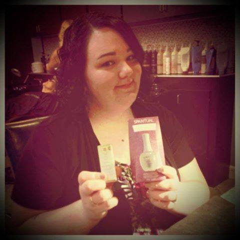 How sanitary are the pedicure basins really?
Professional Reseller
 What kind of mark-ups can you fetch on the clothing you resell from thrift stores?
Great question, Richard! Each storm and location is a little different. Much of the precipitation type is determined above the surface of the earth. The snowflakes form thousands of feet above the ground and stay frozen as they fall. A very shallow layer of air at the surface could be above freezing but not deep enough to melt the snow.
Share Answer: 
Complicated answer, Richard, but a good question. There are quite a few and I really can't give a number off the top of my head. Easily more than a dozen It is complicated because different models offer different solutions. Some are short range, some are longer range. Some are US based, others European and Canada and Japan. To further complicate the issue some models are run as "ensembles" meaning they are run from the basic initial data but small variations are introduced to give different solutions. The basic input data is collected twice a day from about 900 upper air sites, or weather balloons, launched twice a day, noon and midnight Greenwich mean time. The idea is to take a snapshot of the entire planet atmosphere at the same time. Also, more and more data, from satellites and radar for example, is now ingested into the models to varying degrees. A shorter answer is, on a regular day I'll look at three or four.
Share Answer: 
Hi, Reyna. Standard anemometer height is 10 meters.
Share Answer: 
-OR-
 Login with Facebook
 (max 20 characters - letters, numbers, and underscores only. Note that your username is private, and you have the option to choose an alias when asking questions or hosting a Q&A.)
(A valid e-mail address is required. Your e-mail will not be shared with anyone.)
(min 5 characters)
By checking this box, you acknowledge that you have read and agree to Jobstr.com’s Terms and Privacy Policy.
-OR-
Register with Facebook(Don't worry: you'll be able to choose an alias when asking questions or hosting a Q&A.)


 Browse Jobs
 Host a Q&A
 Search

 Submit Your Question
 Host a Q&A
 Last 7

